
News · Jackson
South Fork Forked Deer River: Tennessee takes over 985 acres on Jackson’s south edge to cut flash flooding in East Jackson and Bemis
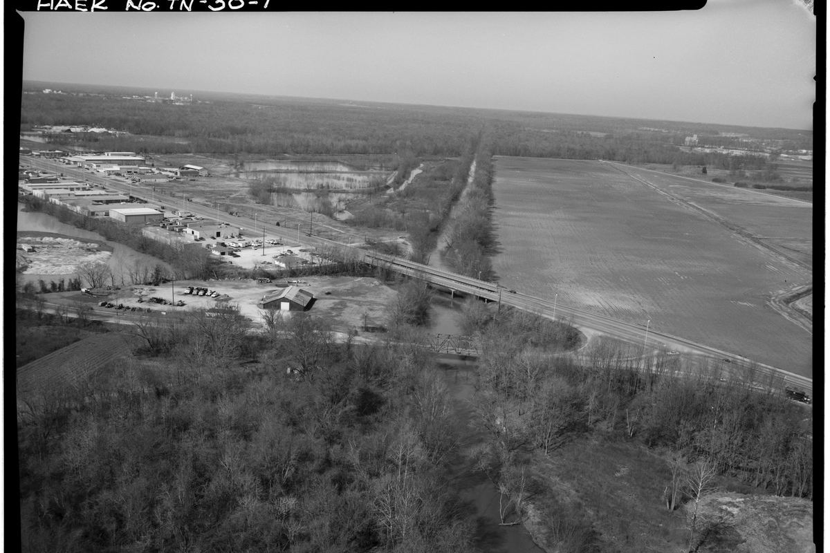
JACKSON — The State of Tennessee now owns 985 acres along the South Fork of the Forked Deer River on Jackson’s southern edge, land that officials say will be reshaped to slow floodwater and reduce flash flooding in nearby neighborhoods.
Local and state leaders marked the acquisition Thursday afternoon, Oct. 29, at the Greater Jackson Chamber, WBBJ-TV reported. Officials from Jackson, Madison County, the state and the West Tennessee River Basin Authority spoke about reducing flooding, improving water quality and protecting the Memphis Sand aquifer.
Where and what
The property lies south of U.S. Highway 70 and west of U.S. Highway 45, according to a joint release from the National Wildlife Federation and its partners. It was owned by the Jones Family Trust until The Nature Conservancy and The Conservation Fund bought it in 2025. The two groups sold it to the state in 2026. The release did not give the purchase price.
The West Tennessee River Basin Authority will restore and manage the land. It still includes pieces of habitat that once covered much of West Tennessee, including cypress swamps, cane brakes and bottomland hardwood forest.
Why it matters for flooding
The South Fork was straightened and channelized in 1916 to drain low-lying land around Jackson. The release says that has led to flash floods that damage infrastructure and fill low areas with sand, despite decades of conservation work.
“Rivers need room and channelized rivers are limited,” said David Blackwood, the basin authority’s executive director. “By reconnecting the river to the floodplain, we can reduce challenges like flash flooding and sediment pollution.”
The plan is to reconnect the river to its old floodplain, which should slow the water, cut erosion and lower flood risk in East Jackson and the Bemis community, the release said.
Blackwood was careful about expectations. “It won’t eliminate a flood plain, a flood plain is a flood plain, but it should improve things,” he told WBBJ.
What comes next
The basin authority is still writing a restoration plan and timeline, so there is no construction date yet. Once the waterways are redesigned to reduce flood risk, the public will be invited into a stakeholder-led planning process to guide public access to the property. The authority also plans to use the land for public education about rivers and floodplains.
“Jackson-area residents should stay tuned because once we have addressed the flooding, we will be asking for public input on the community use and public access elements of this project,” Blackwood said.
Kendall McCarter of the Tennessee Wildlife Federation, a lifelong Jackson resident, said the project will help “restore a portion of the river that has long been dysfunctional.”
Sources:
National Wildlife Federation, “Newly-Acquired Jackson, Tenn. Property Will Reduce Flooding, Provide Outdoor Opportunities,” Oct. 29, 2026 (acreage, location, ownership history, habitats, 1916 channelization, restoration plan, Blackwood and McCarter quotes), https://www.nwf.org/Home/Latest-News/Press-Releases/2026/10-29-26-Jackson-Land-Acquisition
WBBJ-TV, “Leaders mark progress on South Forked Deer River flood control project,” Oct. 29, 2026 (Chamber event, officials, aquifer, Blackwood quote), https://www.wbbjtv.com/2026/10/29/leaders-mark-progress-south-forked-deer-river-flood-control-project/
Photo: George Hornal, Historic American Engineering Record (HAER TENN,57-JACSO,4-1), Library of Congress via Wikimedia Commons, public domain, cropped, https://commons.wikimedia.org/wiki/File:Aerial_view_of_setting,_south_side_of_bridge,_facing_northwest_-_Campbell%27s_Levee_Bridge,_Spanning_South_Fork,_Forked_Deer_River_at_Westover_Road,_Jackson,_Madison_County,_TN_HAER_TENN,57-JACSO,4-1.tif